 Azzam Bilal Chamdy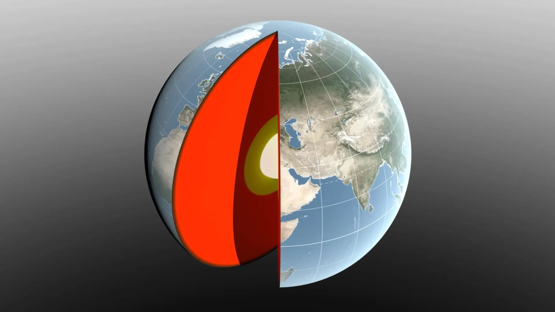
Beneath the surface of our seemingly solid world, a rhythmic, invisible dance is constantly unfolding. As the seasons turn, the relentless cycle of melting ice, shifting ocean currents, and the accumulation of atmospheric pressure redistribute trillions of tons of mass across the globe. This massive movement causes the Earth’s center of mass—the theoretical point where the planet’s gravity is perfectly balanced—to drift back and forth by several millimeters throughout the year.
While these shifts might seem negligible in the context of a planet spanning nearly 25,000 miles in circumference, they represent a significant challenge for modern science. A new study led by NASA’s Jet Propulsion Laboratory (JPL) and published in the Geophysical Journal International has unveiled a groundbreaking method to track these movements with unprecedented precision, effectively rewriting our understanding of how our planet balances its weight.
The Wobble: Defining the Center of Mass
To the casual observer, Earth appears as a stable, solid sphere. However, from the perspective of a satellite in orbit, the planet is a dynamic, fluid system. If the Earth were a perfect, rigid "blue marble," its center of mass would remain permanently aligned with its geometric center.
In reality, Earth is a living, breathing entity. As winter snowpacks grow in the Northern Hemisphere, as the Amazon River basin floods, and as seasonal atmospheric pressure systems swell over continents, the distribution of weight changes significantly. These movements force the Earth’s center of mass to circle its geometric center, creating a constant, minute wobble.
Tracking this motion is not merely an academic exercise. The center of mass serves as the foundational reference point for the global navigation systems (GNSS) that power everything from maritime shipping routes to the precision agriculture that feeds the world. Any uncertainty in the location of this center translates into errors in satellite tracking and surface elevation measurements.
A Legacy of Precision: From Disco Balls to Digital Modeling
For decades, scientists have relied on specialized satellite technology to map these shifts. Among the most iconic tools in this endeavor are the Laser Geodynamics Satellites (LAGEOS 1 and 2). Launched in 1976 and 1992 respectively, these 900-pound spheres are covered in reflective prisms, earning them the nickname "disco balls."
Ground stations spanning more than 20 countries fire lasers at these satellites, measuring the time it takes for the light to return to calculate the exact distance between the station and the satellite. By analyzing these distances, researchers can infer the position of the Earth’s center of mass.
However, this method historically suffered from a "geographic bias." Because most laser tracking stations are located in the Northern Hemisphere, the data were not globally uniform. The new study, spearheaded by JPL geoscientist Donald Argus, resolves this by integrating laser tracking with GPS data and orbital information from low-Earth-orbit satellites. Furthermore, the team accounted for "crustal loading"—the reality that as water and ice accumulate, they physically bend the Earth’s crust, causing the tracking stations themselves to move.
Seasonal Rhythms: The Drivers of Earth’s Shift
The study meticulously cataloged the primary contributors to these seasonal mass shifts, tracing the wobble back to three main sources: the oceans, the atmosphere, and continental water (which includes land ice, groundwater, and soil moisture).
The Amazon and the Arctic
The influence of land-based water is profound. In March, the accumulation of snow across North America and Eurasia reaches its zenith, adding a colossal amount of mass to the Northern Hemisphere. This pushes the Earth’s center of mass approximately 3 millimeters toward the North Pole.
By April, the focus shifts to South America. As the Amazon River basin enters its seasonal peak, holding roughly 2,400 gigatons of rainwater, the massive concentration of liquid pulls the planet’s center of mass 2.2 millimeters toward South America. Later in the year, monsoon patterns in Southeast Asia contribute another 600 gigatons of mass, creating a secondary, albeit smaller, pull.
The Pacific’s Outsized Influence
The oceans act as the planet’s ultimate weight-shifter. From August through October, the combination of rainfall and glacial meltwater flows into the global ocean, with the Pacific basin exerting the greatest influence due to its immense volume. This influx pushes the Earth’s center of mass toward the South Pacific. While smaller seas, such as the Mediterranean, Baltic, and Barents, also contribute, their impact is eclipsed by the sheer scale of the Pacific’s seasonal fluctuations.
Atmospheric Pressure
Finally, the atmosphere contributes its own weight. Using models from the European Centre for Medium-Range Weather Forecasts, researchers found that dense, cold winter air acts as a heavy blanket. Around December 21, high-pressure systems shift the balance toward Arabia, Asia, and northern Africa. Conversely, by June 21, the atmospheric weight shifts toward South America and South Africa.
Official Responses and Scientific Implications
The results of the JPL study are striking. Donald Argus, the lead author, highlighted a significant correction to previous estimates. "We’re now estimating the size of the movement of Earth’s mass center back and forth each year to be about half of what we believed it to be eight years ago," Argus stated. "Our findings suggest that the mass of Earth’s water and air moving between the hemispheres is smaller than previously thought."
This discrepancy is vital. In 2017 and 2023, international estimates of these shifts differed by 0.27 inches (7 millimeters)—a margin of error nearly as large as the movement itself. By cutting this uncertainty, the research provides a much clearer picture of the Earth’s dynamics.
Felix Landerer, a coauthor at JPL, emphasized the practical necessity of this work. "While these movements might appear tiny, our modern world relies on extremely accurate positioning measurements," Landerer noted. "By unraveling and understanding the mechanisms that change reference systems, we can build better reference systems that ultimately benefit mapping and navigation."
Validating the Findings: The GRACE-FO Mission
To ensure the accuracy of their model, the researchers cross-referenced their data with the Gravity Recovery and Climate Experiment Follow-On (GRACE-FO) mission. Launched in 2018 as a partnership between NASA and the German Research Centre for Geosciences (GFZ), GRACE-FO utilizes two satellites flying in tandem.
As these satellites pass over areas with higher mass—such as a river basin swollen with floodwater—the increased gravitational pull slightly alters the distance between the two spacecraft. This "gravitational tug-of-war" allows scientists to map water movement with incredible fidelity. The fact that the new, refined model matches the observational data from GRACE-FO provides strong evidence that the team’s new approach to calculating the center of mass is the most accurate to date.
Looking Toward the Future
The implications of this research are far-reaching. As climate change continues to alter patterns of precipitation, glacier melt, and sea-level rise, the way mass is distributed across the planet will inevitably change. Understanding the "normal" seasonal cycle is the essential first step in identifying long-term, human-induced shifts in the planet’s balance.
The scientific community is already looking ahead to the next stage of this monitoring. With the planned launch of the GRACE-Continuity (GRACE-C) mission in 2028, researchers aim to extend a nearly 25-year record of Earth’s mass movement. This continuity is crucial, as it allows scientists to distinguish between short-term seasonal "wobbles" and the long-term trends that will shape the planet’s future.
In conclusion, the Earth is far more than a static rock spinning in space. It is a dynamic, shifting system where water, air, and ice engage in a perpetual, seasonal exchange of weight. By refining our ability to track these movements, NASA scientists are not only solving a complex puzzle of geophysics but are also ensuring that the infrastructure of our modern world remains anchored to a reality that is, quite literally, always on the move.

 Lina Irawan
 Rifan Muazin
 Nana
Nana
 Ali Ikhwan
 Evan Lee Salim