
 Nana Muazin
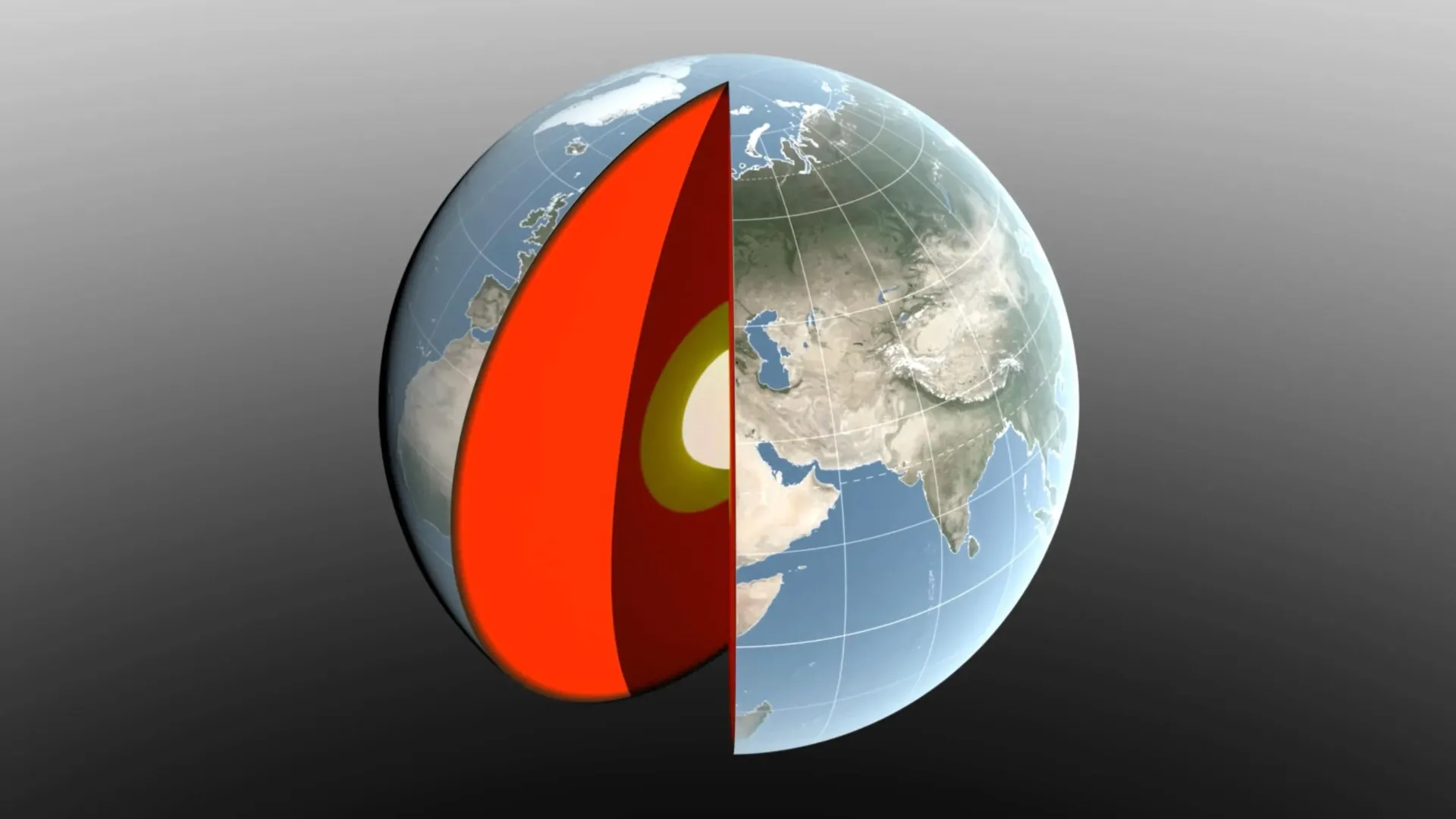
Earth is not the static, rigid sphere we often imagine when gazing at a classroom globe. Instead, it is a dynamic, breathing entity. Every year, trillions of tons of water, ice, and air surge across the planet’s surface, shifting weight in a seasonal choreography that literally displaces the Earth’s center of mass.
While the shift is measured in mere millimeters—an amount invisible to the human eye—it is a critical variable for scientists. A new study, led by researchers at NASA’s Jet Propulsion Laboratory (JPL) and published in the Geophysical Journal International, has unveiled a breakthrough method to measure these movements with unprecedented precision. This discovery not only clarifies the mechanics of our planet’s shifting balance but also refines the fundamental reference systems upon which global navigation, satellite logistics, and precision agriculture rely.
The Fluid Dynamics of a Planetary Core
To understand the Earth’s center of mass, one must first differentiate it from the planet’s geometric center. If Earth were a perfectly solid, homogenous marble, its center of mass would coincide exactly with its geometric center. However, Earth is a complex, active system. Its crust is elastic, its oceans are fluid, its atmosphere is dense, and its polar ice caps are in constant flux.
As seasons change, the redistribution of these massive volumes—water moving from the oceans to the continents, snow accumulating in the northern hemisphere, or air masses shifting due to temperature changes—exerts a "wobble" on the planet. This causes the Earth’s center of mass to orbit its geometric center by a few millimeters throughout the year.
For decades, determining the exact magnitude of this wobble has been a source of scientific friction. Recent international estimates in 2017 and 2023 disagreed by approximately 0.27 inches (7 millimeters)—a discrepancy roughly the thickness of three nickels stacked together. While this sounds trivial, in the world of high-precision geophysics, it is a massive gap that could lead to errors in satellite positioning and surface elevation measurements.
A History of Tracking the Wobble
The pursuit of defining Earth’s center of mass began in earnest during the latter half of the 20th century. Recognizing the need for a global reference frame, scientists launched the Laser Geodynamics Satellites (LAGEOS 1 and 2) in 1976 and 1992, respectively.
These satellites are technological marvels: 900-pound (408-kilogram) spheres covered in hundreds of reflective prisms, earning them the nickname "disco balls" among space researchers. By firing lasers from ground stations across more than 20 countries and measuring the time it takes for the light to bounce back, scientists can determine the satellite’s position with extreme accuracy. Because these satellites orbit the Earth’s center of mass, their trajectories provide a "truth" against which the planet’s shifting center can be measured.
However, the method faced a historical bottleneck: the uneven distribution of ground stations. Most laser-tracking sites are concentrated in the Northern Hemisphere, creating a "blind spot" in data collection that limited the accuracy of global models.
Bridging the Gap: The New JPL Methodology
To overcome the limitations of ground-based laser tracking, the team led by JPL geoscientist Donald Argus developed a multi-layered approach. By integrating laser measurements with GPS tracking and orbital data from various low-Earth-orbit satellites, the researchers created a more holistic observational network.
Crucially, the team also accounted for the "loading" effect. As massive amounts of water and ice press down on the Earth’s surface, the crust itself bends and deforms. By incorporating models of how the Earth’s crust reacts to these weight changes, the researchers were able to correct for the subtle movements of the ground stations themselves.
"We’re now estimating the size of the movement of Earth’s mass center back and forth each year to be about half of what we believed it to be eight years ago," Argus explained. "Our findings suggest that the mass of Earth’s water and air moving between the hemispheres is smaller than previously thought."
The study, a collaborative effort involving the University of Nevada, the University of Montana, and Germany’s Helmholtz Centre for Geosciences, provides a definitive baseline that replaces the conflicting estimates of the previous decade.
The Great Seasonal Weight Shift
The researchers meticulously traced these shifts to three primary drivers: the oceans, the atmosphere, and continental water (which encompasses soil moisture, groundwater, snow, and land ice). The influence of these factors fluctuates throughout the annual cycle, creating a predictable yet intricate pattern of movement.
The Continental Influence
The accumulation of snow and water on land acts as a massive weight on the planetary scale. For instance, in March, when snow accumulation across North America and Eurasia reaches its annual peak, the added weight shifts the Earth’s center of mass roughly 3 millimeters toward the North Pole.
The Amazon River basin also plays a significant role. In April, as the basin hits its peak, it holds approximately 2,400 gigatons of rainwater. This concentration of mass exerts a gravitational pull that shifts the center of mass 2.2 millimeters toward South America. Conversely, the monsoon season in Southeast Asia, peaking in November with 600 gigatons of water, provides a smaller but distinct directional tug.
The Oceanic and Atmospheric Balance
The Pacific Ocean acts as a gravitational anchor due to its sheer volume. From August through October, the influx of meltwater and seasonal rainfall pushes the center of mass toward the South Pacific. While smaller seas, such as the Mediterranean, Red, and Baltic, contribute to the movement, their effects are dwarfed by the oceanic "heave" of the Pacific.
Atmospheric pressure adds a final, ephemeral layer to the dance. Utilizing data from the European Centre for Medium-Range Weather Forecasts, researchers calculated that the shift in dense, cold winter air moves the balance toward Arabia, Asia, and northern Africa on December 21, and toward South America and South Africa on June 21.
Confirming the Data: The Role of GRACE-FO
The findings of the JPL team were bolstered by data from the Gravity Recovery and Climate Experiment Follow-On (GRACE-FO) mission. Launched in 2018 as a partnership between NASA and the German Research Centre for Geosciences (GFZ), GRACE-FO tracks the movement of mass by measuring changes in Earth’s gravitational field.
The mission consists of two satellites traveling in a precise formation. As they pass over regions with higher mass—such as a flooded river basin or a mountain range with heavy snow—the leading satellite is pulled slightly faster, changing the distance between it and its partner. By measuring these micro-fluctuations, scientists can "weigh" the water and ice moving across the planet, confirming the mass redistribution models used by Argus and his team.
Implications for a High-Tech World
While a few millimeters of displacement may seem negligible to the average person, the implications for modern technology are profound. We live in an era of precision, where global shipping logistics, autonomous vehicle navigation, and precision agriculture rely on reference systems accurate to the centimeter.
"While these movements might appear tiny, our modern world relies on extremely accurate positioning measurements," says Felix Landerer, a JPL coauthor of the study. "By unraveling and understanding the mechanisms that change reference systems, we can build better reference systems that ultimately benefit mapping and navigation."
For a farmer using GPS-guided tractors to plant seeds with centimeter-level accuracy, or a shipping company optimizing routes through volatile oceanic currents, the stability and accuracy of these reference frames are essential. If the reference frame shifts without being accounted for, the entire map "wobbles," leading to systemic errors that could impact everything from infrastructure construction to climate monitoring.
Looking Toward the Future
The study represents a milestone in geodetic science, but the work is far from finished. The Earth continues to change, and with climate-driven shifts in ice-sheet mass and sea-level rise, the patterns of mass redistribution are evolving.
NASA is already looking toward the next phase of observation. The GRACE-Continuity (GRACE-C) mission, scheduled for launch in late 2028, will ensure that this vital record of Earth’s mass movement remains uninterrupted. As we continue to refine our understanding of how our planet moves, we gain not only a better map of the world but a deeper appreciation for the delicate, shifting balance that sustains life on Earth.
By mastering the measurement of these tiny, seasonal wobbles, humanity is better equipped to navigate an increasingly complex and interconnected world, ensuring that our digital tools remain as reliable as the ground—however slightly it may move—beneath our feet.

 Raul Delapena Setiawan

 Laily UPN

 Reynand Wu
 Sagoh


 Azzam Bilal Chamdy

 Ali Ikhwan
