
 Basiran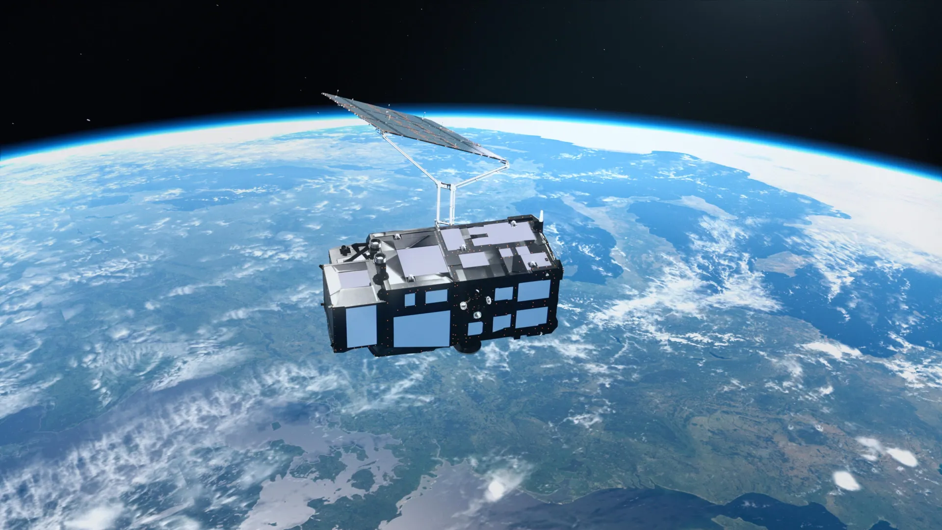
Just two weeks after its successful launch into orbit, Europe’s latest high-tech sentinel, the Copernicus Sentinel-3C, has begun transmitting a stream of data that promises to reshape our understanding of a planet in flux. From the snow-dusted peaks of the Alps to the fragile, retreating ice of the Canadian Arctic and the radiant turquoise shallows of the Caribbean, the satellite’s first imagery is more than a display of orbital photography—it is a powerful declaration of intent.
As the third iteration in the Copernicus Sentinel-3 series, this spacecraft is a sophisticated instrument suite designed to provide a continuous, high-resolution heartbeat of Earth’s vital signs. While the breathtaking visuals capture the public’s imagination, the true value of Sentinel-3C lies in its ability to measure ocean topography, track the thinning of Greenland’s ice sheets, and monitor the shifting health of global vegetation.
The Vanguard of Environmental Intelligence
The Sentinel-3 program represents the backbone of the European Union’s Copernicus Earth observation mission. By maintaining a constant, watchful eye on the oceans, land, atmosphere, and cryosphere, these satellites provide the foundational data required for modern climate science.
Sentinel-3C is engineered to be a comprehensive observer. Over the oceans, it monitors sea surface temperature, color, and height, providing essential metrics for tracking marine heatwaves and the encroaching threat of sea-level rise. On land, it serves as a global sensor for droughts, wildfires, and vegetation vitality, while also providing critical oversight of water levels in rivers and lakes.
The European Space Agency (ESA) is currently in the midst of a rigorous five-month commissioning and calibration phase. This period is vital for ensuring that the satellite’s sensors are synchronized and delivering the high-precision data that the global scientific community demands. Despite being in its infancy, the satellite has already demonstrated that its instruments—particularly the ocean and land color instrument and the radar altimeter—are performing well within expected parameters.
A Chronology of Early Successes
The journey of Sentinel-3C from launch to its first data transmissions has been a testament to European aerospace engineering.
- Launch and Deployment: Following its successful insertion into orbit, the satellite underwent a series of critical system deployments, ensuring that its solar arrays and antennas were correctly positioned to power its intensive mission.
- Initial Imaging (September 29–30): Within days of reaching its operational orbit, the satellite captured its first series of images. On September 29, it turned its lenses toward the Caribbean, showcasing the vibrant contrast between shallow reef waters and the deep, dark expanse of the Atlantic.
- Land and Sea Mapping (September 30): The satellite captured a sweeping view of Italy and the Mediterranean. This image demonstrated the craft’s ability to distinguish between diverse land cover, agricultural heartlands, and sediment-rich coastal waters.
- Arctic Observations (September 30): Simultaneously, the satellite surveyed the Canadian Arctic Archipelago. These images captured the stark, frozen beauty of a region currently experiencing rapid, climate-driven degradation.
- Commissioning Phase (Present – Future): The mission is now entering a long-term calibration process. ESA and its partners are currently preparing to bring the sea and land surface temperature radiometer online, which will add a new dimension of thermal monitoring to the existing data stream.
Supporting Data: From Orbit to Reality
The technical prowess of Sentinel-3C is best illustrated by its ability to translate light and radar waves into actionable scientific data.
The Italian Mosaic
The image captured on September 30 across the Italian peninsula serves as a proof-of-concept for the satellite’s land-color instrument. By mapping the transition from the Po Valley—Italy’s agricultural powerhouse—to the snow-capped Alps, the sensor provides researchers with a baseline for measuring the seasonal health of European vegetation. Along the Adriatic coast, the distinct light-blue plumes of sediment are not merely aesthetic; they provide oceanographers with a window into coastal currents and the impact of inland runoff on marine ecosystems.
The Arctic’s Vanishing Reflectivity
The imagery of the Canadian Arctic is perhaps the most somber of the initial releases. Captured near the time of the annual sea-ice minimum, the photographs highlight the precarious state of the northern cryosphere. The contrast between the brilliant white of the ice and the dark, open ocean is critical. As the ice melts, the ocean absorbs more solar radiation, creating a feedback loop that accelerates regional warming. Sentinel-3C’s ability to monitor these ice fragments in tandem with its altimetry instruments allows scientists to calculate volume loss with unprecedented accuracy.
Ocean Heights and Sea-Level Rise
Perhaps the most crucial mission objective for Sentinel-3C is its radar altimeter. By bouncing radar pulses off the sea surface, the satellite can calculate ocean height to within centimeters. Early testing has already yielded data on sea-surface height across the Atlantic and Mediterranean. When compared against established multimission data from the Copernicus Marine Service, the results align perfectly, validating the satellite’s precision. This is vital for maintaining the continuity of data since 1999, a period during which global sea levels have risen at an accelerating rate of approximately 3.64 mm per year.
Official Perspectives and Operational Oversight
The success of the Sentinel-3C mission is the result of a long-standing partnership between the European Space Agency and the European Organisation for the Exploitation of Meteorological Satellites (Eumetsat).
"The performance we are seeing in these initial weeks is extremely encouraging," says a representative from the ESA mission control team. "Every instrument is responding exactly as our models predicted. We are currently in the phase of fine-tuning, ensuring that every pixel and every radar return is calibrated to the highest scientific standards before we hand the satellite over for full, routine operations."
Following the commissioning phase, the management of the mission will be bifurcated to optimize efficiency. Eumetsat will take the lead on routine daily operations and the dissemination of marine and atmospheric data, while ESA will continue to oversee the land, cryosphere, and inland water products. This collaborative model ensures that the vast, complex datasets produced by the satellite are distilled into useful information for policymakers, climate modelers, and emergency responders worldwide.
The Global Implications
The deployment of Sentinel-3C arrives at a critical juncture for climate policy. As nations struggle to meet the goals of the Paris Agreement, the need for objective, high-frequency, and transparent data has never been greater.
Monitoring the "Climate Heartbeat"
The data provided by Sentinel-3C will serve as the foundation for the Copernicus services. These services provide everything from flood risk assessments to agricultural yield predictions. By identifying long-term trends—such as the gradual warming of the Mediterranean or the shifting vegetation patterns in the Po Valley—scientists can move beyond reactive modeling and into the realm of proactive climate adaptation.
Preparing for a Rising Tide
For low-lying island nations, the data from the radar altimeter is a matter of national survival. As the satellite contributes to the global record of sea-level rise, it provides the empirical evidence necessary for coastal communities to build defenses and plan infrastructure. The ability to track the elevation of Greenland’s ice sheet with such precision is equally significant; as these massive reservoirs of ice continue to melt, the resulting contribution to sea-level rise will dictate the global humanitarian and economic response to climate change over the next century.
A New Standard for Earth Observation
Ultimately, Sentinel-3C represents a triumph of international cooperation. By providing its data on an open-access basis, the European Union ensures that researchers in developing nations, academic institutions, and private enterprises all have the same high-quality tools to observe the planet.
As the mission progresses through its testing phase and toward full operational capacity, it stands as a sentinel in the truest sense of the word. It is a guardian of information, a silent observer that provides the clarity needed to navigate a warming, changing, and increasingly unpredictable world. While the images of the Caribbean’s turquoise waters and the Alps’ rugged peaks are undeniably beautiful, they serve as a reminder of what we stand to lose—and what we are now better equipped to protect.


 Lina Irawan
 Asep Darmawan
 Neng Nana
 Nana Muazin
 Jia Lissa
 Laily UPN